HOW MUCH SNOW? LET’S TALK:
Our first snowflakes of the year are on the way, but will it be a big deal? No. Will we get a slushy coating to a light accumulation in spots. We continue to think so. Colder air will rush across the lakes behind a strong low pressure to our east starting Thursday. Lake effect rain will be dominant on Thursday before colder air aloft and at the surface begins to change the rain over to a mix of rain and snow. At times we’ll likely changeover to all snow in spots Thursday night. Friday would feature more lake effect rain and snow before the entire system begins to pull east this weekend.
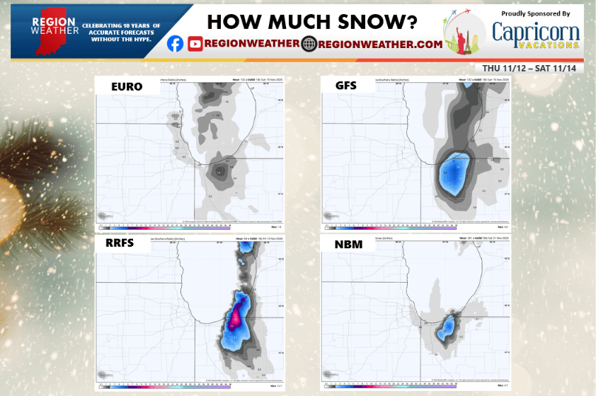
Take a look at 4 of the more trusted models below. See the big range from not much to over a half foot of snow? Why the difference? The models are naturally having a tough time figuring out when and where the rain changes over to snow–and add to that how long it stays snow in spots. We’ll likely see precip types flopping back and forth between rain and snow during much of this event–so amounts won’t be determined until it’s actually happening as they will also vary from neighborhood to neighborhood. The impacts are what matters and it will turn pretty gross around here Thursday into Friday where that lake effect persists. We’ll keep you updated as always, but wanted to be transparent about all the forecasts you’re seeing!
Capricorn Vacations is a good spot to start if you want to get away from all of this and end up on a nice warm beach!