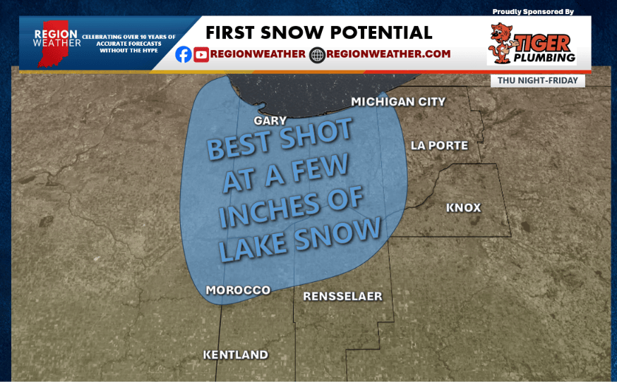
FIRST SNOW ON THE WAY
It’s that time of year, so nothing unusual here…but this first one always has a slight shock value to it! Lake effect rain will eventually mix with and changeover to wet snow tonight into early Friday. Temps are coming in a degree or two colder this morning on model guidance–the result? Higher snow accumulations in the forecast. Guidance still varies greatly as it does with lake effect events, but a slushy coating to a few inches of snow is possible overnight. The epicenter with our northeast fetch off the lake would target Lake County into northern Newton County–but we could see some of the banding set up in Porter County and northern Jasper County as well! LaPorte and Starke County may miss out on this one for a change! Be prepared to brush off that car tomorrow morning and for a slower commute where the snow persists overnight.